Where Is Chichen Itza? Location and Map
Chichen Itza is an inland Maya city in the municipality of Tinum, Yucatan, Mexico: not in Cancun, not on the coast, and not on an island. This page puts it on the map at every scale, from the country down to where each great building stands inside the fence.
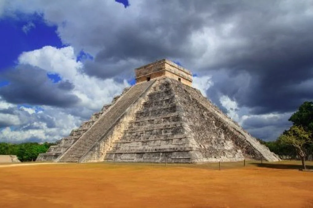
We run the shared Chichen Itza tour described near the end of this page, and we are a young operator with a short record. Everything geographical here comes from the published sources named at the foot of the page.
Where Chichen Itza Is: The Short Answer
Chichen Itza is in the municipality of Tinum, in the state of Yucatan, Mexico, in the northern interior of the Yucatan Peninsula. It is an inland archaeological site, not a coastal one: the nearest town is Piste, about 2 km away, and the nearest city is Valladolid, roughly 40 to 45 km east. The state capital, Merida, lies about 120 km west; Cancun, in the neighbouring state of Quintana Roo, is about 195 to 200 km east by road.
That one paragraph answers most versions of the question, including the misspellings and word orders it arrives in: where is Chichen Itza located, where is it situated, Chichen Itza location in Mexico, and the accented form, donde esta Chichen Itza. The sections below give the same answer at every map scale, from the country down to the paths inside the fence, because the search family splits exactly that way: some people want the country, some want the pin, and some want to know where the pyramid stands inside the site.
Chichen Itza is not in Cancun, not in the state of Quintana Roo, and not on an island or a beach. Cancun is simply where most visitors sleep. The ruins stand on the flat limestone plain in the middle of the peninsula, which is also why the journey to them is a real drive in every direction, a point the transport comparison covers mode by mode.
Country, State and Municipality: Mexico, Yucatan, Tinum
At the largest scale: country, Mexico; state, Yucatan; municipality, Tinum. The archaeological zone's postal address sits on the federal highway corridor between Merida and Valladolid, and the site is administered nationally by INAH, Mexico's National Institute of Anthropology and History, which is why the federal part of your entrance fee is paid to INAH (the full split is explained on the tickets and entrance fee page).
The Yucatan Peninsula itself is shared by three Mexican states: Yucatan in the northwest, Quintana Roo on the Caribbean side, and Campeche in the southwest, with Belize and Guatemala's Peten below them. Chichen Itza belongs to Yucatan state, in its east-central interior, close enough to the Quintana Roo border that a day trip from the coast crosses a state line and a time zone line on the way, one hour back as you travel west (the ruins keep Yucatan time, UTC-6; Cancun keeps UTC-5).
The municipality matters for one practical reason: when a map app, a taxi driver or a tour confirmation says "Chichen Itza, Tinum", that is the ruins, not a different place. Piste, the town that serves the site with hotels, restaurants and the bus stop, is in the same municipality, a couple of kilometres from the gate.
Coordinates and the Address to Enter
The coordinates most maps publish for the archaeological zone are 20.6843 degrees N, 88.5678 degrees W. Enter "Chichen Itza" or "Zona Arqueologica Chichen Itza" in any map app and you will land on the visitor entrance side of the zone, where entry now runs through the CATVI visitor centre (what that changes on the ground is covered in the inside-the-site guide).
Two pins, both right: some services pin the zone at slightly different coordinates (Apple Maps, for example, places it at 20.68296 N, 88.56865 W). The difference is a few hundred metres inside a very large archaeological zone: one pin marks the monumental core, the other the entrance side. It is not two different sites, and it does not matter for navigation, because every pin routes you to the same highway exit and the same visitor entrance.
The highway is Federal Highway 180, the Merida to Cancun corridor, with the toll motorway 180D running parallel for the long stretches. There is no commercial airport at the site and no flight lands anywhere near it: every visit arrives by road, which is why location questions and transport questions travel together for this place.
On the Yucatan Peninsula: Limestone, Water and Why a City Stands Here
The peninsula is a flat shelf of limestone with almost no surface rivers. Rain sinks through the rock and collects in natural sinkholes, cenotes, where the water table breaks through. A large city could only exist where those wells were reliable, and Chichen Itza grew around two of them: the Sacred Cenote to the north and Cenote Xtoloc near the southern groups. The city's own name says it: Chichen Itza means "at the mouth of the well of the Itza" (the name is unpacked on the Chichen Itza facts page, and the wells themselves in what is a cenote).
One map error is worth correcting while we are here, because it appears on otherwise good maps: the famous Ring of Cenotes, the arc of sinkholes tracing the buried Chicxulub crater rim, passes north of Chichen Itza. The ruins and Cenote Ik Kil are not on the ring; they sit outside it, in the same limestone but not on the crater's edge. The crater story, and where the ring actually runs, is told in the Chicxulub crater and cenotes guide.
Regionally, Chichen Itza sits near the eastern end of the old Maya world of the northern lowlands: Uxmal and the Puuc hills lie southwest (compared honestly in Chichen Itza vs Uxmal), the colonial city of Merida northwest, and the Caribbean coast, with Tulum's cliff-top ruins, southeast.
The Chichen Itza Map: Where Everything Stands Inside the Fence
The visitor site has two great halves. The north holds the Great North Platform: El Castillo at the centre of the Great Plaza, the Great Ball Court to the northwest, the Temple of the Warriors and the Thousand Columns to the east, and, about 300 m north along a straight sacbe (a raised Maya road), the Sacred Cenote. The south of the main circuit holds the Central and Osario groups: the Osario pyramid, El Caracol the observatory, and the Las Monjas group. A separate sector further south, Chichen Viejo, is not part of the normal visit at all (it is reservation-only; see the lesser-known structures guide).
The shape of the visit: cenote at the north end, pyramid at the centre, the older southern groups behind you as you face it. Chichen Viejo lies off this map, further south, and opens by reservation only.
The core is walkable but not small: published guides put the monumental core at roughly 2.5 km end to end, and a full loop of every major structure at about 4 to 5 km of walking. Which order to walk it in, and where the facilities are, belongs to the inside guide and the visitor guide; this page's job is only to put everything on the map. The headline buildings each have their own guide: El Castillo, the Great Ball Court, the Temple of the Warriors, El Caracol and the Sacred Cenote.
Distances on the Map: How Far Chichen Itza Is from Each City
Road distances, printed as the approximate figures published sources agree on, with the honest spread where they differ. These are map distances for orientation; journey times, modes and fares belong to the transport pages linked in the last column.
| From | Road distance (approx.) | Direction | Full comparison |
|---|---|---|---|
| Piste (nearest town) | about 2 km | Beside the site | Inside guide |
| Valladolid | 40 to 45 km | East | From Valladolid |
| Merida | about 120 km | West | From Merida |
| Tulum | about 150 km | Southeast | From Tulum |
| Playa del Carmen | about 175 to 180 km | East | From Playa del Carmen |
| Cancun | 195 to 200 km | East | From Cancun |
Two orientation facts follow from the table. First, Valladolid is the closest real base: under an hour away, which is why the shared tour stops there on the way back rather than treating it as a detour. Second, Merida is the closest big city, which is why the Merida departure is the shortest day of the five city tours. If you are choosing where to sleep, the Valladolid guide covers the town itself.
See Where Chichen Itza Is, on the Shared Tour
If you're planning a day trip to Chichen Itza, our shared tour also includes a swim at Cenote Ik Kil and a stop in Valladolid. It costs $130 per adult and $115 per child up to age 12, including the 697 MXN Chichen Itza entrance fee. We pick you up at your own hotel or pickup point in whichever of the five cities you're staying in, and confirm your exact pickup time on WhatsApp the night before the tour. A 30% advance reserves your place, with the balance due on the tour day. Cancellation is free up to 48 hours before the tour, and the advance is refunded in full. We're a new operator, and we say so plainly.
City pages: Chichen Itza tour from Cancun · from Tulum · from Playa del Carmen
Price calculator
The 697 MXN Chichen Itza entrance fee is included in these prices: nothing extra to pay at the gate for entry.
Chichen Itza Location: Questions, Answered
Where is Chichen Itza located?
In the municipality of Tinum, in the state of Yucatan, Mexico, in the northern interior of the Yucatan Peninsula. The nearest town is Piste, about 2 km away, and the nearest city is Valladolid, roughly 40 to 45 km east.
Is Chichen Itza in Cancun?
No. Chichen Itza is in Yucatan state, about 195 to 200 km west of Cancun by road. Cancun is in the state of Quintana Roo. Most visitors sleep in Cancun and visit the ruins as a day trip, which is why the two are so often confused.
What are the coordinates of Chichen Itza?
The widely published coordinates are 20.6843 degrees N, 88.5678 degrees W. Some map services pin the zone a few hundred metres away, at the entrance side rather than the monumental core; both pins are the same archaeological zone.
Where is Chichen Itza on a map of Mexico?
On the Yucatan Peninsula, the thumb of land in the southeast of Mexico: in the northern interior of the peninsula, between Merida to the west and Valladolid to the east, well inland from both the Gulf and Caribbean coasts.
How big is the Chichen Itza site?
The monumental core visitors walk is roughly 2.5 km end to end, and a full loop of every major structure is about 4 to 5 km of walking. The wider archaeological zone, including Chichen Viejo to the south, is much larger than the fenced visitor circuit.
What is the closest city to Chichen Itza?
Valladolid, about 40 to 45 km east, is the closest city. Merida, the state capital, is about 120 km west and is the closest large city. Piste, about 2 km away, is the closest town.
Is Chichen Itza on the Ring of Cenotes?
No. The Ring of Cenotes, the arc of sinkholes along the buried Chicxulub crater rim, passes north of the site. Chichen Itza and Cenote Ik Kil are in the same limestone country but are not on the ring itself.
Which airport is closest to Chichen Itza?
Merida and Cancun are the two practical airports, both a long drive away; there is no airport at the site. Airport-to-ruins routes are compared on the transport pages rather than here, because every option is a road journey.
Check Your Date on WhatsApp
Booking opens on WhatsApp: that is where your date is checked, your pickup point is set, and your exact pickup time is confirmed the night before the tour. Send one message with:
- Your tour date
- Your pickup city and hotel or pickup point
- How many adults and children (to age 12)
$130 per adult · $115 per child · 697 MXN entrance fee included · 30% advance to reserve · free cancellation up to 48 hours before.
Start with your date
One tap opens the conversation. Prices above are the full per-person prices: the entrance fee is already in them.