Chicxulub, the Crater That Made the Cenotes: The Complete Guide
The swim on our tour is in a hole dissolved into limestone, a window into an underground river system that is northern Yucatan's only water. About 66 million years ago an asteroid fell just off this coast and left a buried crater whose rim still organises the groundwater in the northwest: a ring of cenotes traces it to this day. But the honest geography corrects the popular version, including the version told about this site's own cenotes. Chichen Itza is not on that ring, and this page shows the geometry rather than asking you to take it on trust.
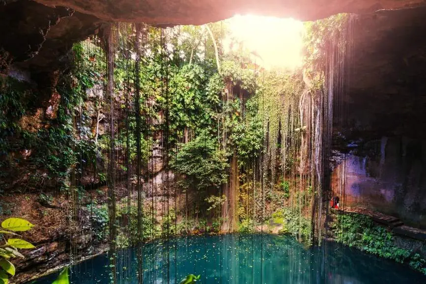
We run the shared Chichen Itza tour described near the end of this page. We are a new operator with a short record. That is stated plainly here rather than dressed up. Everything about the crater and the cenotes comes from the published sources named on this page, not from us.
The Numbers, Graded
Every Chicxulub retelling opens with numbers, and most of them are printed with more confidence than the evidence carries. This box is this page's discipline in one place: the core figures, each in the form the sources actually support: ranges where the sources give ranges, uncertainties where they publish them.
| Figure | As published | Grade |
|---|---|---|
| When | About 66 million years ago, at the Cretaceous–Paleogene boundary. A recalculated impact-melt age of 66.05 ± 0.18 million years (Schmieder & Kring 2020) may be cited with its uncertainty, a bare "exactly" figure is over-precise and is not used here. | EstablishedRenne et al. 2013; Schulte et al. 2010 |
| The impactor | Roughly 10 km across. Alvarez et al. (1980) estimated 10 ± 4 km; modern model descriptions run ~10–15 km. Attributed as a model figure, never an exact size. | Model-dependent |
| Crater diameter | An attributed range of ~180–200 km: ~180 km (Hildebrand et al. 1991), ~180 km as a minimum outer-fault diameter in later geophysics, ~200 km in other descriptions, 190–210 km in a 2019 fracture study. | Established as a range |
| Burial | Under several hundred metres to ~1 km of later sediment (Kring / Lunar and Planetary Institute; NASA). The crater is not a visible bowl. | Established |
| Original depth | Figures around ~20 km describe the original structure in NASA's explainer, an attribute-only figure for the crater as formed, never a depth you could measure today, and never to be confused with burial depth. | Attributed only |
Hold those gradings through everything that follows. Where this page gives an energy equivalent, a wave height or a climate figure, it is reporting a model's output with the model named: §2 keeps that rule explicitly.
What Happened 66 Million Years Ago
EstablishedAt the boundary between the Cretaceous and Paleogene periods, an asteroid of roughly 10 km struck the shallow sea off the Yucatan coast, near today's town of Chicxulub Puerto, which is where the crater takes its name. The impact excavated a transient cavity that collapsed within minutes into the broad, multi-ringed structure whose buried outline geophysics maps today: a crater on the order of 180–200 km across, with a raised peak ring inside it, a ring of fractured mountains thrown up by the collapse, later drilled and sampled (§3). The site was coastal then as now; the crater straddles the modern shoreline, part under the Gulf of Mexico, part under the land.
Model results: attributed, not observedEverything dramatic in the standard retelling comes from modelling, and it is published here as modelling. Impact models describe an energy release vastly greater than the world's combined nuclear arsenals, mega-tsunamis crossing the Gulf, ejecta and sulphur-rich vapour injected into the stratosphere, and a global "impact winter" of darkened, cooled skies lasting years. These are serious, peer-reviewed reconstructions of an event no one witnessed; the figures attached to them, wave heights, temperature drops, fire extents, vary between models, and this page does not narrate any of them as observed fact. What is observed is the geology: the crater itself, the global boundary clay with its iridium and shocked minerals, and the fossil record's abrupt break (§4).
Then the crater disappeared, not by erosion into a valley you can visit, but by burial. Sediments settled over it for 66 million years until several hundred metres to about a kilometre of rock hid it completely. The Yucatan landscape above it today is flat limestone plain. There is no rim to climb and no bowl to photograph; the crater exists on gravity maps, in drill cores and in the arc of cenotes that §5 follows.
How Scientists Found a Crater They Cannot See
The discovery is a four-step story, and each step is often mis-told one step too strong. Told at its documented strength, it is better.
1980: a layer of iridium, and a hypothesis
DocumentedIn 1980 the Alvarez team reported in Science that the thin clay layer marking the Cretaceous–Paleogene boundary, sampled in Italy and elsewhere, carried an anomaly of iridium, an element rare in the Earth's crust and common in asteroids. They proposed an extraterrestrial impact as the cause of the end-Cretaceous extinction. Note what that paper did not do: iridium alone located no crater. For a decade the hypothesis had an effect in search of a hole.
The Pemex anomalies: Penfield and Camargo
DocumentedThe hole, meanwhile, had already flickered across oil-company instruments. In the late 1970s, exploration by Mexico's state oil company Pemex had found gravity and magnetic anomalies and unusual rocks in the northern Yucatan. Geophysicist Glen Penfield and Pemex's Antonio Camargo identified a great buried circular structure and presented it as a possible impact crater in 1981, and again in 1991. That is the documented claim, a structure identified, and it is not the stronger claim, sometimes printed, that the impact was proven in the 1970s. It was not; the proof took the next step.
1991: Hildebrand names the crater
DocumentedIn 1991, Hildebrand and colleagues, publishing in Geology, identified the buried Chicxulub structure as the crater of the boundary impact, on the combined evidence of the geophysics, shocked quartz (mineral grains deformed in ways only impact pressures produce) and impact melt rock from the Pemex cores. From 1991 the crater had a name, a place and a size: about 180 km, in their first estimate.
2016: drilling the peak ring
DocumentedIn 2016, IODP–ICDP Expedition 364 drilled the crater's peak ring offshore, recovering core from 505.7 to 1,334.73 metres below the seafloor, about 99% of it recovered, shocked, fractured granite, impact melt and suevite (Morgan et al., Science 2016). The core is the show-don't-tell proof of the whole story: granite that had been kilometres deep, shattered and lifted into a ring by the collapse, exactly as the dynamic-collapse model of peak-ring formation predicts. A crater nobody can see has been held in human hands, one core barrel at a time.
Did It Kill the Dinosaurs?
The consensus, preciselyYes, as the primary cause. In 2010, Schulte and colleagues published in Science a review of the evidence by 41 experts, concluding that the Chicxulub impact was the primary cause of the end-Cretaceous mass extinction. That is the position this page states, at exactly that strength: a reviewed expert consensus, not a lone paper and not a slogan.
The scale, graded: around three-quarters of species disappeared, published as approximate (the Smithsonian gives ~75%; some sources give ~80%, printed here as the variant), never as a measured count, because nobody counted; the figure is reconstructed from the fossil record. And the victims, stated exactly: all non-avian dinosaurs became extinct. Birds are surviving dinosaurs. The dinosaur lineage did not end at Chicxulub; its largest branches did. Extinction also took the ammonites, the marine reptiles and much else, while mammals, birds, crocodilians and many smaller lineages crossed the boundary.
The Ring of Cenotes
Established in the literature since 1995In 1995, Perry, Velazquez-Oliman and Marin published in Geology the observation that gives this page its second half: the cenotes of northwestern Yucatan are not scattered evenly. They trace a semicircular arc, the Anillo de Cenotes, the Ring of Cenotes, whose curve matches the buried rim of the Chicxulub crater. Later geophysical work (a characterisation study of 2013) confirmed the correspondence. The ring is the one place on Earth where an asteroid's buried architecture is written on the surface in water.
The figures, with their distinction kept: the ring's schematic diameter is ~180 km, a radius of ~90 km, while geophysics places the cenote concentrations at ~70–85 km radially from the crater's centre, varying by sector. Both are published, and they are not a contradiction: the first is the idealised circle of the diagram, the second is where the cenotes actually cluster along a real, irregular structure. On land, the belt runs roughly Celestún → Tekit → Homún → Huhí, a chain of cenote country across the northwest, with the rest of the arc lost under the Gulf.
Its formal status, stated carefully: the Ring of Cenotes is on Mexico's UNESCO Tentative List, submitted in 2012. A tentative listing is a nomination file, a first step. It is not a World Heritage inscription, and this page does not present it as one.
How a Ring of Cenotes Forms Around a Buried Crater
The supported mechanismThe mechanism is quieter than the story it replaces. The impact fractured the rock along its rim and left zones that compacted and settled differently from the rock inside and outside the crater. That fractured, differentially compacted band is more permeable: groundwater flows through it more readily than through the surrounding limestone. Where groundwater flow concentrates, limestone dissolution concentrates with it: more flow, more dissolved rock, more caves, more collapses, more cenotes. Sixty-six million years after the impact, the rim's fracture pattern is still steering the water, and the water is still engraving the rim's outline on the surface.
Two clarifications keep the mechanism honest. First: the asteroid did not dig the cenotes. No cenote is an impact pit or a fragment of the crater; each one is younger water-work, dissolved and collapsed long after the crater was buried. Second: the ring is not an exposed rim, not a ridge, not a scarp, not a circle you can see from the air. It is a hydrogeological expression of buried structure: the crater influencing the present through water, which is stranger and more interesting than a visible scar would be.
Did the Asteroid Make Every Cenote?
Rim fracturing concentrated one arc of cenotes, the northwestern ring of §5. The peninsula's other cenotes, thousands of them, were made by its limestone and its rain: the ordinary karst process of §10, working everywhere the platform's carbonate rock and the water table meet. The impact explains the ring's pattern. It did not excavate a single cenote anywhere, not on the ring, and not off it.
The shorthand in this page's own title, "the crater that made the cenotes", survives only in the graded sense this section gives it: the crater's buried rim organised one famous arc of them. Read any stronger version anywhere, including a version of this site's own headline, against §6's mechanism. Geology gave Yucatan its limestone; rain gave it the acid; the aquifer did the dissolving; the asteroid, at most, told one arc of the work where to concentrate.
Are Chichen Itza and Ik Kil on the Ring?
Against the ring's ~90 km radius, Chichen Itza lies roughly 125 km southeast of the crater's centre (approximate), on the order of 40 km beyond the ring's arc. Ik Kil, about 3 km from the ruins, stands with it. The site's cenotes, the Sacred Cenote, Xtoloc and Ik Kil, belong to the wider peninsula karst, formed by the same dissolution process as cenotes across Yucatan. Claims that Ik Kil sits "right on the crater ring" circulate online; they are a myth, and the geometry below is the correction. No evidence exists that the Maya sited Chichen Itza with any knowledge of the buried crater, a structure invisible to them and to everyone until the age of geophysics.
So the true sentence about this tour's swim is the unglamorous one, and it loses nothing by being true: Ik Kil is a magnificent collapsed cenote in the same aquifer system that the ring belongs to, connected by geology and by water, not by the crater's rim. The full guide to the cenote itself is the Cenote Ik Kil guide.
Why Northern Yucatan Has Cenotes Instead of Rivers
Established: USGS karst mechanicsThe Yucatan platform is limestone, porous, fractured carbonate rock. Rain that falls on it does not gather into streams; it sinks, percolating down through the rock into a vast underground aquifer, which is the region's water supply. The United States Geological Survey describes northern Yucatan as having extensive underground drainage and few to no permanent surface rivers. A landscape drained from below instead of across its surface develops exactly the features this page is about: caves, sinkholes, and cenotes where the caves break through.
Two disciplines ride with that, and both are printed because both are commonly got wrong. First, the geography: the peninsula as a whole is not riverless, the claim belongs to the north; southern Yucatan and the wider peninsula have different geology and do have rivers. Second, the cause: the asteroid is not the reason for the missing rivers. Permeable carbonate geology is. The limestone platform was laid down as marine sediment long before the impact and would drain exactly the same way had no asteroid ever fallen; Chicxulub's contribution to Yucatan's water is one arc of concentrated cenotes in the northwest, nothing more, and nothing less.
How a Cenote Forms
The process is slow chemistry plus one moment of gravity. In words, step by step:
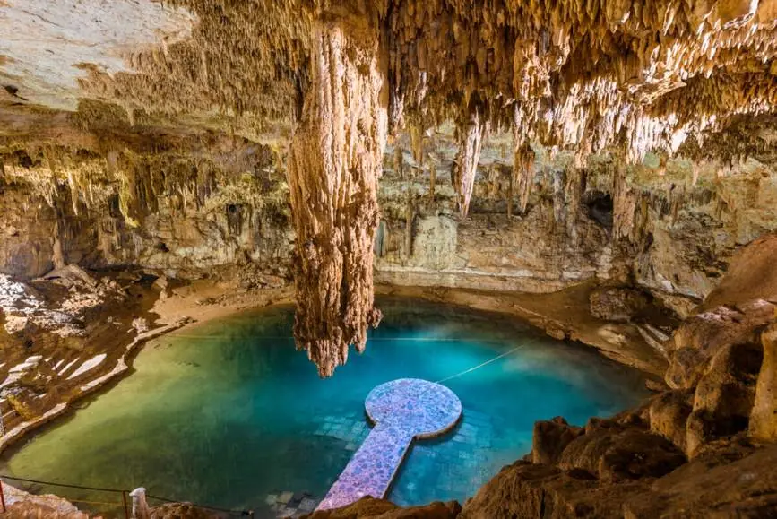
One qualification, stated because the tidy version overclaims: not every cenote is a sudden collapse. Dissolution from above, and water tables that rose and fell with past sea levels, also shape cenotes, widening some openings grain by grain, drowning some caves and draining others. Collapse is the dramatic ending of one common pathway, not a universal birth story, and this page does not print it as one.
The Types of Cenote
Descriptive morphology onlyCenotes are commonly sorted by shape into four loose families. The categories are descriptive, a field guide's convenience, not a scientific classification, and no universal four-part taxonomy exists; this page uses the families at exactly that strength, and does not print the popular claim that the types are simply stages of age, oldest to youngest.
| Type | What it looks like | Example on this site |
|---|---|---|
| Open | Fully exposed to the sky, a wide, open pool where the roof has gone entirely. | Ik Kil, and Saamal in the Hubiku & Saamal guide |
| Semi-open | Partly roofed: an opening in the cave ceiling lets a shaft of light and rain into a still-sheltered pool. | None |
| Cavern / closed | Reached underground, inside a roofed cave; the water lies in a vaulted chamber lit through small openings. | Suytun and Hubiku |
| Well-shaped shaft | A steep, near-cylindrical shaft dropping straight to the water, the pit form of the Sacred Cenote at Chichen Itza itself. | The Sacred Cenote guide |
Venues get one line each here because this page owns the geology, not the swimming: each cenote above has its own full guide, linked in the table, with its own access, rules and swim details.
Fresh Water Over Salt Water: The Halocline
Descend through a Yucatan cenote and, in the parts of the aquifer near the coasts, you cross one of hydrogeology's strangest boundaries. The aquifer is not fresh all the way down: fresh water floats on top of denser salt water that intrudes from the sea through the limestone, and the transition layer between them is the halocline. Divers know it by sight: cross it and the water blurs, as if a lens had been smeared, where the two waters of different density mix.
The numbers, at passage depth and with their limits printed: the halocline's depth varies considerably with distance from the coast. A 2023 study of the eastern Yucatan aquifer found it at roughly 5–10 metres below the water table near the Caribbean coast, and deeper inland, where the fresh lens thickens. And one absence, stated as a decision: no Ik Kil-specific halocline depth exists in the sources, so none is published here: a figure invented for the tour's own cenote would be exactly the kind of precision this page exists to refuse.
How Many Cenotes Are There?
Ask the question plainly and the sources answer with four different numbers: all of them defensible, none of them interchangeable. Published as an attributed range, with the disagreement explained rather than averaged away:
| Figure | What it counts | Source |
|---|---|---|
| More than 6,000 | The common estimate in tourism and geology writing | Widely cited general figure |
| 7,000–8,000 | Estimate for Yucatan state | UADY (Autonomous University of Yucatan) researchers, reported August 2026 |
| 8,000–9,000 | Regional estimates, with more than 900 inside the ring | Oceanographic Magazine |
| ~3,050 registered | A registered inventory, counted, documented cenotes, for Yucatan state | State sustainability secretariat figures, reported 2026 |
The two distinctions that explain the spread: estimates versus registered inventories: an estimate models how many sinkholes the karst should hold, including undiscovered and unrecorded ones, while a register counts only those someone has documented, so the register is always the smaller number, and Yucatan state versus the whole peninsula, which adds Campeche and Quintana Roo to the count. Any single exact figure, printed without saying which kind of count it is, has skipped the part that makes the number mean anything.
Why This Mattered at Chichen Itza
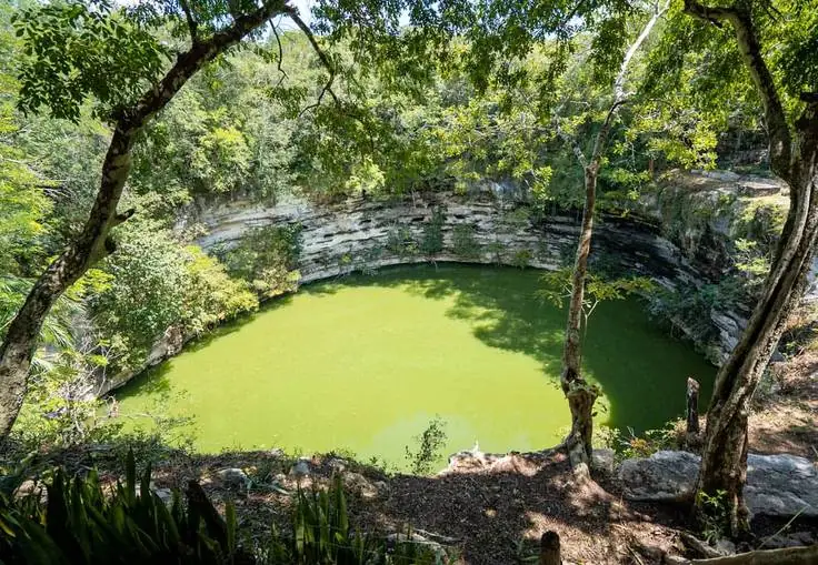
One passage, because the depth belongs to other pages: Chichen Itza grew into a great city on a plain with no surface river to drink from. Its water was this aquifer, reached through its cenotes, above all the Sacred Cenote and Xtoloc, and a riverless city's dependence on holes in the limestone shaped where it built, how it stored water and what it held sacred. The city's own story is told in The Itza: The People Who Built Chichen Itza, and the Sacred Cenote's archaeology in its own guide; this page's point is only the geology underneath both, the same dissolved limestone, the same underground water, that you will swim in at Ik Kil.
The same geology explains the wells the city was built around; for the city itself, start with the visitor guide to the site.
The Swim at Ik Kil
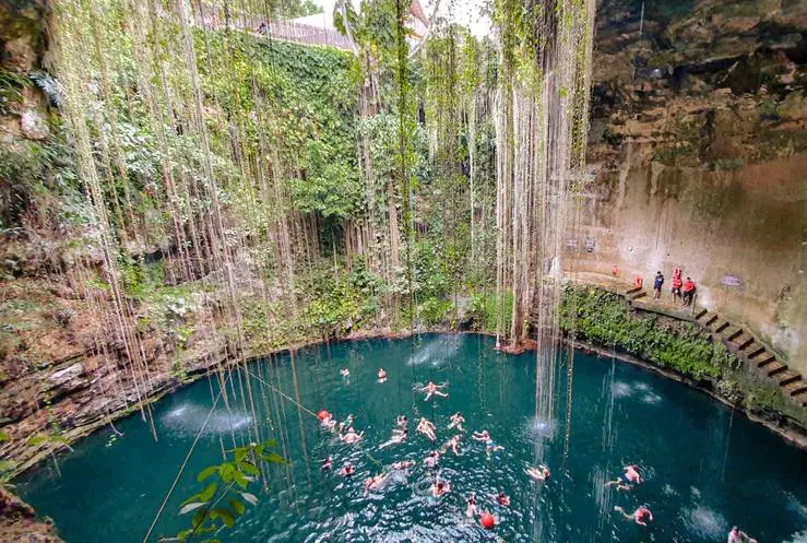
Which makes the tour's swim a piece of fieldwork. Ik Kil, about 3 km from the ruins, is a collapsed, open window over the same aquifer that fed Chichen Itza and that the ring traces in the northwest, not a crater relic, as §8 established, but the living surface of the peninsula's underground water. When you float in it, you are floating in the water table itself, in a shaft dissolved grain by grain out of ancient seabed limestone. Everything practical, access, the swim, rules and timing, is in the Cenote Ik Kil guide.
See It on the Shared Tour
Our shared tour is a day trip to Chichen Itza, a swim at Cenote Ik Kil, and a stop in Valladolid: $130 per adult, $115 per child up to age 12, with the 697 MXN Chichen Itza entrance fee included in that price. We pick you up from your own hotel or pickup point, and your exact pickup time is confirmed on WhatsApp the night before. To reserve, a 30% advance is paid, with the balance on the day of the tour; cancellation is free up to 48 hours before the tour, with the advance refunded in full. We are a new operator, and we say so plainly.
City pages: Chichen Itza tour from Cancun · from Tulum · from Playa del Carmen
Price calculator
The 697 MXN Chichen Itza entrance fee is included in these prices, nothing extra to pay at the gate for entry.
Chicxulub and the Cenotes: Frequently Asked Questions
What is the Chicxulub crater?
The Chicxulub crater is the buried impact structure left when an asteroid struck the Yucatan coast about 66 million years ago, at the end of the Cretaceous period. It is roughly 180 to 200 kilometres across, published as an attributed range, not one figure, and it lies under several hundred metres to about a kilometre of later sediment near the town of Chicxulub Puerto. Nothing of it is visible at the surface; it was found through gravity and magnetic surveys, drilling and shocked minerals, not by looking at the ground.
How big was the asteroid that killed the dinosaurs?
Roughly 10 kilometres across. The Alvarez team estimated 10 plus or minus 4 kilometres in 1980, and modern model descriptions run from about 10 to 15 kilometres. Any single exact size would be false precision: the impactor was destroyed in the impact, so its size is inferred from the crater and the iridium layer, and honest sources give it as an approximate figure or a model range.
How big is the Chicxulub crater?
About 180 to 200 kilometres across, published as an attributed range. Hildebrand and colleagues reported about 180 kilometres in 1991; later geophysics treats roughly 180 kilometres as a minimum outer-fault diameter, other descriptions run to about 200 kilometres, and a 2019 fracture study gives 190 to 210 kilometres. The figures differ because they measure different edges of a buried, eroded structure, so this page never prints one diameter as settled.
What is the Ring of Cenotes?
The Ring of Cenotes, the Anillo de Cenotes, is a semicircular arc of cenotes in northwestern Yucatan whose curve matches the buried rim of the Chicxulub crater. Published in the journal Geology by Perry, Velazquez-Oliman and Marin in 1995, the ring has a schematic diameter of about 180 kilometres, with cenote concentrations lying roughly 70 to 85 kilometres from the crater's centre, varying by sector. The cenotes cluster there because fracturing along the rim made the limestone more permeable, so groundwater flow and dissolution concentrate along the arc.
Did the asteroid create all the cenotes in Yucatan?
No. The impact's buried structure helps explain one arc of cenotes, the Ring of Cenotes in the northwest, where rim fracturing concentrated groundwater flow and limestone dissolution. The peninsula's thousands of other cenotes formed the ordinary karst way: rainwater made slightly acidic by carbon dioxide dissolving limestone over immense spans of time, hollowing caves whose roofs sometimes collapsed. The asteroid dug none of them; every cenote is younger water-work in limestone.
Is Chichen Itza on the Ring of Cenotes?
No. The ring is an arc of roughly 90 kilometres radius around the crater's centre near Chicxulub Puerto, in the northwest of Yucatan. Chichen Itza lies roughly 125 kilometres southeast of the centre, distances approximate, which puts it on the order of 40 kilometres beyond the ring's arc. Its cenotes, the Sacred Cenote and Xtoloc among them, belong to the wider peninsula karst, not to the Ring of Cenotes.
Is Cenote Ik Kil on the crater rim?
No. Honestly, it is not. Ik Kil stands about 3 kilometres from the Chichen Itza ruins, roughly 125 kilometres southeast of the crater's centre, while the crater's rim and its ring of cenotes lie at roughly 90 kilometres radius in the northwest. Ik Kil is a collapsed window over the same peninsula aquifer, formed by limestone dissolution like cenotes across Yucatan; it is not a crater-rim cenote, and claims that it sits right on the crater ring are a myth this page corrects.
Why does Yucatan have cenotes but no rivers?
Because northern Yucatan is limestone. Rain does not collect into surface streams; it sinks through the porous, fractured rock into an underground aquifer, dissolving caves as it goes, and cenotes are the openings where those caves reach the surface. The United States Geological Survey describes northern Yucatan as having extensive underground drainage and few to no permanent surface rivers. Two qualifications matter: the peninsula as a whole is not riverless, the south differs, and the asteroid is not the reason; permeable carbonate geology is.
How does a cenote form?
Rainwater takes up carbon dioxide from the air and the soil and becomes a weak carbonic acid. Moving through the limestone, that acid slowly dissolves the rock along pores, joints and fractures, hollowing caves at the water table. Where a cave roof loses support, it collapses and opens a window down to the groundwater: that window is a cenote. Not every cenote is a sudden collapse: dissolution and changes in the water table shape many of them gradually.
How many cenotes are there in Yucatan?
Sources disagree, and the disagreement is explained by two distinctions: estimates versus registered inventories, and Yucatan state versus the whole peninsula. The common tourism and geology figure is more than 6,000; researchers at the Autonomous University of Yucatan estimate 7,000 to 8,000 for Yucatan state; regional figures reach 8,000 to 9,000, with more than 900 inside the ring; and a registered inventory counts about 3,050 in Yucatan state. There is no single exact count, and any source printing one without saying which kind of count it is has skipped the important part.
Did the Chicxulub impact kill the dinosaurs?
It was the primary cause of the end-Cretaceous mass extinction, that is the conclusion of Schulte and colleagues' 2010 review in Science, written by 41 experts. Around three-quarters of species disappeared; the figure is approximate, published at about 75 percent by the Smithsonian with about 80 percent in some sources, never a measured count. All non-avian dinosaurs became extinct; birds are surviving dinosaurs. India's Deccan Traps eruptions spanned the same interval and may have stressed the climate, but they do not displace the impact as the primary cause.
¿Qué es el anillo de cenotes?
El anillo de cenotes es un arco semicircular de cenotes en el noroeste de Yucatán cuya curva coincide con el borde enterrado del cráter de Chicxulub. Lo describió el estudio de Perry, Velazquez-Oliman y Marin en la revista Geology en 1995: su diámetro esquemático es de unos 180 kilómetros y las concentraciones de cenotes se sitúan a unos 70 a 85 kilómetros del centro del cráter, según el sector. Los cenotes se agrupan ahí porque la fracturación del borde hizo la caliza más permeable, y el agua subterránea y la disolución se concentran a lo largo del arco. Es una lista tentativa de la UNESCO desde 2012, no una inscripción de Patrimonio Mundial.
Check Your Date on WhatsApp
Booking opens on WhatsApp: that is where your date is checked, your pickup point is set, and your exact pickup time is confirmed the night before the tour. Send one message with:
- Your tour date
- Your pickup city and hotel or pickup point
- How many adults and children (to age 12)
$130 per adult · $115 per child · 697 MXN entrance fee included · 30% advance to reserve · free cancellation up to 48 hours before.
Start with your date
One tap opens the conversation. Prices above are the full per-person prices, and the entrance fee is already in them.